Laser Scanning Systems - study material
3. Measurement Using Terrestrial Laser Scanners
3.2. Scanning
Scanning means the procedure of the determination of spatial coordinates of points, which are lying on the surface of the measured object. It is also possible to obtain radiometric information (color) about the measured object during the scanning. This information is the intensity of the reflected measuring signal or colors (textures) from the images captured by digital cameras often embedded in the scanning system.
Scanning consists of the definition of scanning parameters and of starting the scanning procedure. The scanning parameters define the area and the density of the scanned points on the surface of the scanned object. Laser scanners, which are equipped with a digital camera, enable us to define the scanning area directly on the digital image in the shape of a spherical rectangle. For most scanners, it is possible to define a scanning area also by starting and ending horizontal direction and zenith angle. The next important parameter is the scanning density (resolution) because this parameter influences the detail of measurement and consequently the amount of the data obtained by scanning. The resolution can be set by the definition of the angular difference between two consecutive points and profiles, it means by definition of the step for the horizontal and vertical angle Δω, Δζ, or by definition of raster parameters in a certain distance from the scanner, e.g., 3 mm × 3 mm per 50 m. To simplify the control of the instrument, some producers limited the possibility to set the scanning parameters only to define the scanning area and to choose the scan resolution from some predefined resolutions. The resolution in these systems is mainly defined as a number of points per 360° in the horizontal and vertical direction, e.g., 40,960 points per 360°, which represents 1.5 mm x 1.5 mm per 10 m, eve. 7.7 mm × 7.7 mm per 50 m.
After starting the measurement, scanning is performed automatically without any necessary intervention of the user. The scanning procedure is controlled by a control unit embedded in the instrument or by an external computer. The scanner determines the spatial coordinates of points and saves them into the internal memory of the instrument or into the control PC. In addition to coordinates, radiometric information is obtained during the measurement. This information is the intensity of the reflected measuring signal or color from the images captured by a digital camera. The measuring signal is reflected off the measured object with various intensities that depend on the physical characteristics of the scanned surface (material, color, roughness). On the base of the radiometric information, it is possible to assign a color to measured points (Fig. 7).
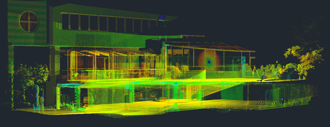
Figure 7 Result of scanning – point cloud (colored according to intensity)
The results of the scanning procedure are point clouds in coordinate systems of the scanner at particular stations and the above mentioned radiometric information.